New Zealand's 2027 flood map release to omit coastal groundwater risk
This digest was compiled by AI from multiple sources — links to the originals are below.
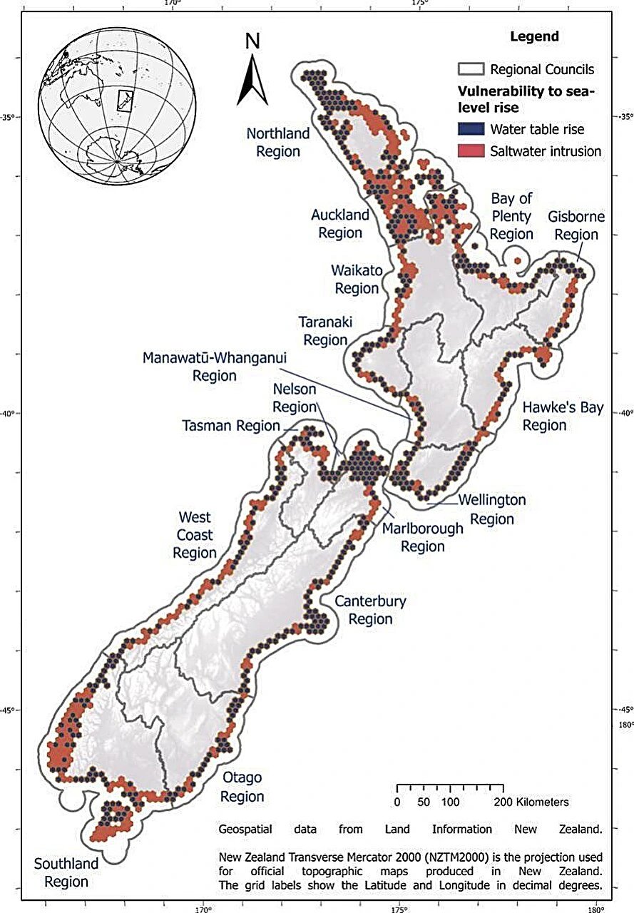
New Zealand will release updated nationwide flood maps in 2027 without data on shallow coastal groundwater, which rises with sea level, according to Phys.org. The omission leaves groundwater flooding and saltwater intrusion risks unrepresented across about 9,000 square kilometers of low-lying coastal land where nearly one in five New Zealanders live.
The Omission
New Zealand's updated nationwide flood maps, scheduled for release in 2027, will exclude water-table data from shallow coastal aquifers. Coastal groundwater fluctuates seasonally and rises with sea level over the long term, but these changes are rarely included in adaptation planning tools. Low-lying coastal areas span about 9,000 square kilometers, or just over 3% of New Zealand's total land area, and nearly one in five New Zealanders live in these areas.
Groundwater Response
Where coastal water tables are free to rise with sea level, they rise toward the surface and increase groundwater flooding risk while maintaining fresh groundwater flow to the coast and limiting saltwater intrusion. Where low, flat topography holds the water table down, flow to the coast weakens and saltwater intrusion risk increases. Along much of New Zealand's coastline, the water table lies just meters, sometimes centimeters, below the surface, yet these processes rarely enter adaptation planning.
Infrastructure and Water Supply
Rising seas can fill coastal aquifers high enough to spill over the land surface before ocean saltwater breaches the coastline, damaging natural resources, agricultural land, and built environments. Saltwater intrusion threatens drinking water supplies and coastal ecosystems, including in river valleys and basins such as the Hauraki Plains and Canterbury Plains. Current planning focuses on surface water, even though the water table lies just meters or centimeters below much of New Zealand's coastline.
What's Next
The updated maps are scheduled for release in 2027, with no groundwater layer included in the current scope. It remains unclear whether regional councils will add local aquifer monitoring data or whether adaptation planning will proceed without this subsurface hazard information.
1 source
New Zealand's 2027 flood map release to omit coastal groundwater risk