
Petermann Glacier creates 76 km² ice island, largest Arctic calving since 2020
This digest was compiled by AI from multiple sources — links to the originals are below.
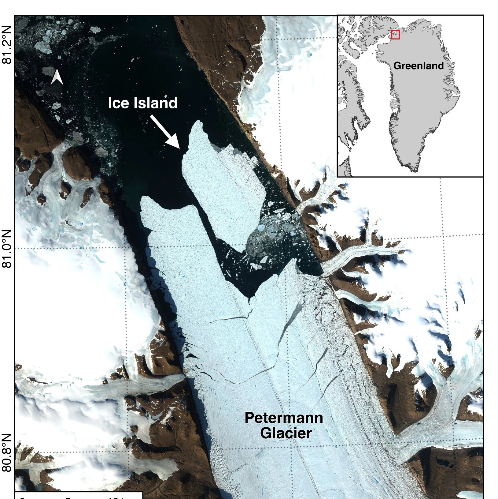
Petermann Glacier in northwest Greenland calved a 76.4 km² ice island on Aug. 4, 2026, its largest floating ice loss since 2012 and the biggest Arctic calving event since 2020. The tabular iceberg, up to 150 meters thick and comparable in area to Manhattan Island, was detected by an international research team led by the University of Ottawa.
The Break
Adam Garbo, a doctoral student in glaciology at the University of Ottawa, detected the calving through long-term satellite monitoring that has tracked changes at Petermann Glacier since 2019. Satellite imagery from the European Space Agency's Sentinel-1 mission showed clear deterioration along the centerline of the ice tongue on Aug. 3, and the iceberg detached from the eastern side by 20:00 UTC on Aug. 4. The collaboration involves the University of Ottawa, the University of Stirling, Environment and Climate Change Canada, Lancaster University and the University of Leeds. The newly formed ice island has a surface area of 76.4 km²—roughly the size of Manhattan—and is estimated to be up to 150 meters thick.
Monitoring and Significance
Researchers had been following the glacier's floating ice tongue for years, documenting the growth of fractures and monitoring signs of instability. 'We’ve anticipated this break for years, and seeing it finally happen is remarkable,' said Garbo. Dr. Anna Crawford of the University of Stirling noted that Arctic ice islands are far rarer than the large tabular icebergs common in Antarctica, offering critical insights into glacier retreat, ocean conditions and ice hazards. Studying these Arctic formations provides knowledge that can be transferred across polar regions, she added.
1 source
Time · lag behind first