
Hurricane Polo intensifies to rare category 5 off Mexico
This digest was compiled by AI from multiple sources — links to the originals are below.
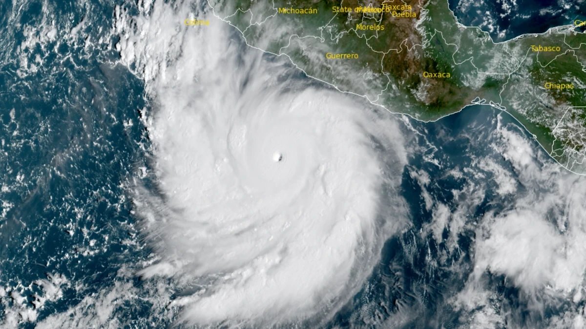
Hurricane Polo rapidly intensified off Mexico's Pacific coast to a category 5 storm with sustained winds near 180 mph, NOAA said Tuesday. The storm is forecast to skirt the coast without landfall, but will bring torrential rain and life-threatening surf to Jalisco, Colima and Michoacan. President Claudia Sheinbaum warned residents to remain vigilant even as the storm's intensification was called 'truly remarkable' by forecasters.
Key Facts
- A NOAA Hurricane Hunter aircraft recorded sustained winds near 180 mph (285 km/h) in Hurricane Polo on Tuesday.
- Polo is the third category 5 storm of the Pacific season and is expected to remain at that intensity for several days.
- Daily sea surface temperatures in the central-eastern Pacific were 3.05C above average on 19 September, exceeding the 2015 El Niño record of 3.02C.
- Rainfall totals of up to 6 inches (15 cm) are forecast for Mexico's south-west coast, with 8 inches possible in some areas.
- President Claudia Sheinbaum named Jalisco, Colima and Michoacan as the states at risk from the storm.
Storm Intensity
NOAA's National Hurricane Center in Miami called Polo 'extremely dangerous' and said its 24-hour intensification was 'truly remarkable'. The storm is fuelled by extremely warm ocean waters linked to the El Niño climate phenomenon. Data from the Hurricane Hunter aircraft indicated Polo could still strengthen and would likely stay a category 5 storm for the next few days. NOAA described the environment as 'very conducive' to the storm's maintenance, citing extremely warm ocean waters.
Coastal Impact
Polo is predicted to skirt the coast of south-western Mexico without making landfall, according to a NOAA warning. The storm will drive torrential rainfall in parts of Mexico's south-west coast, which could lead to deadly flooding and mudslides. Residents have been warned of large ocean swells and life-threatening surf conditions for the next few days. President Claudia Sheinbaum said on Tuesday that Polo would not make a direct landfall but urged vigilance along the Pacific coast.
El Niño Record
Scientists monitoring ocean temperatures say the current El Niño is now the strongest on record. Daily sea surface temperatures in a key region of the central-eastern Pacific were 3.05C above average on 19 September, exceeding the previous record of 3.02C set during the very strong El Niño of 2015. Some longer-term measures of El Niño have not yet hit record levels but this is likely to change, with the peak not expected until later this year. Warmer ocean waters allow storms to pick up more energy, leading to higher wind speeds.
2 sources
Time · lag behind first