
Kazakhstan to auction geologically surveyed sites to investors from 2027
This digest was compiled by AI from multiple sources — links to the originals are below.
Kazakhstan will begin auctioning prospective subsoil sites identified through state geological surveys to investors starting in 2027. The Ministry of Industry and Construction announced the plan during a review of geological exploration work in the Ulytau region. The auctions are part of a broader effort to expand geological coverage and attract investment.
Key Facts
- Kazakhstan plans to auction the first prospective subsoil sites to investors starting in 2027.
- In 2026, geological mapping at a scale of 1:50,000 began on 20 sites across 11 regions, covering more than 100,000 km².
- In the Ulytau region, comprehensive geological surveys are underway on 7 sites covering 36,000 km².
- About 300 wells have been drilled in the Ulytau and Abai regions.
- A unified digital cadastre of subsoil is being created, with electronic passports for each prospective site.
Geological Survey Expansion
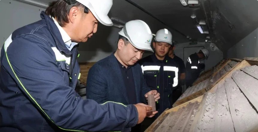
Kazakhstan launched geological mapping at a scale of 1:50,000 on 20 sites across 11 regions in 2026. The total surveyed area exceeds 100,000 km². In the Ulytau region, comprehensive geological surveys cover 7 sites with a total area of 36,000 km². Minister of Industry and Construction Yersaiyn Nagaspaev inspected the ongoing work in the Ulytau region.
Technology and Drilling
Kazakhmys Barlau LLP is conducting advanced aerogeophysical surveys, including aeromagnetic, aerogamma-spectrometric, and aerogravimetric methods, in the Ulytau region. About 300 wells have been drilled in the Ulytau and Abai regions. Kazgeology JSC, part of Tau-Ken Samruk National Mining Company, uses modern unmanned aerial systems with RTK navigation and high-precision positioning. Specialists apply remote sensing data interpretation, unmanned aerogeophysical complexes, and the high-precision Ionic Leach geochemical method.
Digital Cadastre and Auctions
A unified digital cadastre of subsoil is being formed under the state geological survey program. The cadastre will include electronic passports for each prospective site, increasing transparency and accessibility of geological information. The first prospective sites are planned to be auctioned to investors starting in 2027.
1 source
Time · lag behind first