US and EU shutter controls blind independent satellite imagery over Gulf conflict zones
This digest was compiled by AI from multiple sources — links to the originals are below.
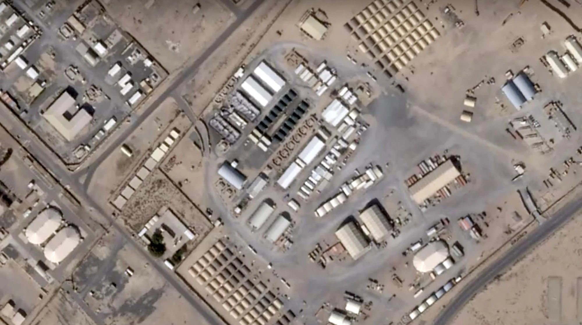
US authorities asked satellite imagery providers to withhold imagery over Iran, allied bases, and Gulf conflict zones starting March 9, and the EU Council on July 13 delayed Copernicus imagery over the Gulf of Oman. The Washington Post verified 109 Iranian-published satellite images against Copernicus and Planet data, confirming damage to 228 structures across 15 sites in six countries. Independent monitors including the Institute for the Study of War and Amnesty International lost access to primary imagery sources.
Key Facts
- The Washington Post geolocated 128 satellite images published by Iranian state-affiliated media and verified 109 of them against Copernicus Sentinel-2 and Planet imagery.
- At least 228 structures and pieces of equipment were damaged or destroyed across 15 sites in six countries, including hangars, barracks, fuel bladders, a power plant, Patriot and THAAD equipment, and an E-3 Sentry.
- Planet Labs imposed a 96-hour delay on new imagery over Gulf states, Iraq, Kuwait and adjacent conflict zones in early March, extended to 14 days on March 10, and moved to a managed access model after April 4.
- On July 13, the Council of the EU adopted a decision requiring the European Commission to delay release of Copernicus imagery over a defined area of the Gulf of Oman, specified by five sets of coordinates covering the shipping approaches to the Strait of Hormuz.
- The Institute for the Study of War said it could no longer confirm strikes or assess damage at the same level of detail, and Amnesty International lost access to a primary source for investigations in Lebanon.
Shutter Control Sequence
In early March, Planet Labs imposed a 96-hour delay on new imagery over the Gulf states, Iraq, Kuwait and adjacent conflict zones. On March 10, the delay went to 14 days. On April 4, the company told customers the United States government had asked all satellite imagery providers to "voluntarily implement an indefinite withhold," retroactive to March 9, covering Iran, allied bases, the Gulf states and active conflict zones. Planet moved to a managed access model, releasing imagery case by case. Vantor's high-resolution imagery of U.S. and coalition forces was already unavailable to media under what the company describes as longstanding policy.
EU Copernicus Delay
On May 26, U.S. authorities submitted a diplomatic démarche to the European Union. On July 13, the Council of the EU adopted a decision requiring the European Commission to delay release of Copernicus imagery over a defined area of the Gulf of Oman. The area was specified in an annex by five sets of coordinates covering the shipping approaches to the Strait of Hormuz. The instrument used was the EU's Space Threat Response Architecture.
Independent Monitor Impact
The Institute for the Study of War said it could no longer confirm strikes or assess damage at the same level of detail. Amnesty International lost access to a primary source for investigations in Lebanon. The Washington Post found no evidence that any of the 109 verified Iranian-published images were faked.
1 source
US and EU shutter controls blind independent satellite imagery over Gulf conflict zones